 |
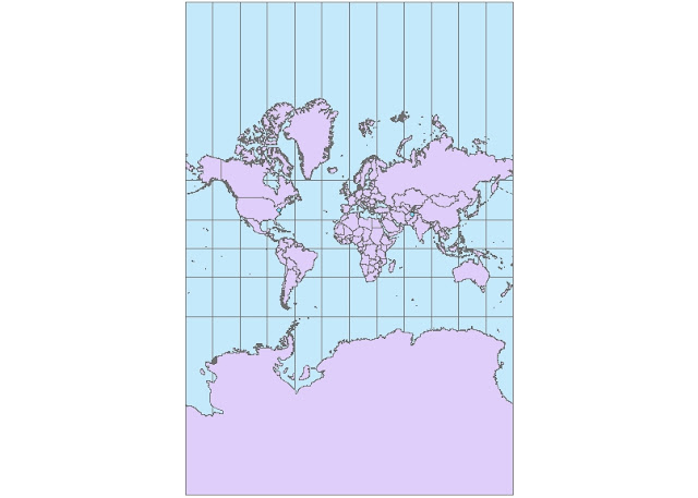
| Mercator Map (Conformal) |
 | |
| Two Point Equidistant |
 |
| Cylindrical Equal Area |
 |
| Equidistant Cylindrical |
 |
| Pole Lambert Azimuthal Equal Area |
 |
| World Stereographic (Conformal) |
There are various types of map projections. Some can look like a realistic view of the earth from space while others shape the earth in ways that make it completely unrecognizable. Each projection has its own distinct properties and therefore they have their own functions.
Certain maps are better for navigation. Specifically the conformal types of maps. These maps have lines that are the incidental. Meaning they have parallel line that keep the shape of the earth more or less accurate. Conformal types of maps are also known as orthomorphic map projections. The Mercator projection and the Stereographic projections are both conformal and although they don't keep the exact shape of large objects like the continents (especially Africa) they have a consistent direction throughout all points on the map. The Mercator projection is even used for marine navigation.
There are more Equidistant maps than other types of map projections. Equidistant maps have certain uses that rely more on proportionate distances rather than actual angles. They always keep the scale consistent. These projections are large scale and are mostly used for air travel, like the equidistant cylindrical map projection above.
Equal Area maps are mostly used for geology mostly because they (you guessed it) preserve area. They correct the mistake of the Mercator projection that shows Greenland a few times larger than it should be, making it larger than Africa. For example: the Equidistant Cylindrical (shown above) clearly shows the difference in size between Greenland and Africa. Map projections are generally important because they let us understand our positions in the earth at any given point not only through visuals but through mathematical analysis (making us albe to navigate ourselves accurately)
No comments:
Post a Comment