Source: http://dougmccune.com/blog/2010/06/05/if-san-francisco-crime-was-elevation/.
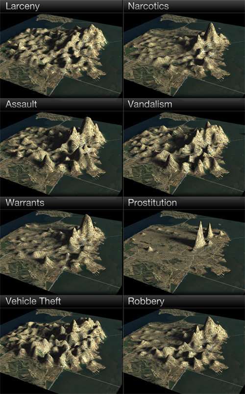
The map is titled "If San Francisco Crime Were Elevation," and it shows various crimes (Larceny/Narcotics/Assault/Vandalism/Warrants/Prostitution/Vehicle Theft/Robbery) and how frequently they occur in certain places among the same region. I found this map on another blog of a person who somehow specializes in GIS and Data visualization (posted June 5th, 2010). I find this map interesting because it makes the information given is simple to process. The map is visually attractive and easily grabbing attention. I particularly like the fact that the elevated crime rates resemble hills and valleys (nice touch with the shadows), and this map is also a good indicator of which places to avoid at night during a trip to San Francisco.
No comments:
Post a Comment